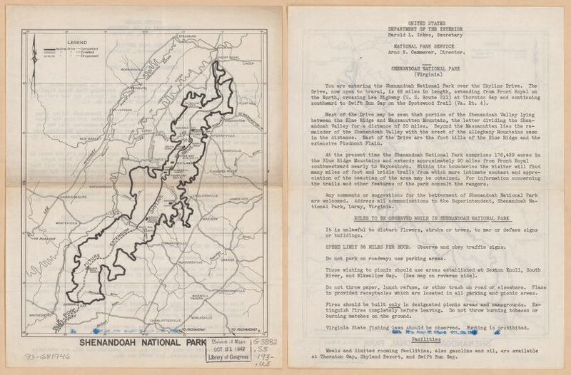
Shenandoah National Park.
Dublin Core
Title
Shenandoah National Park.
Subject
Shenandoah National Park, Skyline Drive
Description
1934 map of Shenandoah National Park.
Creator
[Washington, D.C.] : U.S. Dept. of the Interior, National Park Service.
Source
National Park Service.
https://www.loc.gov/resource/g3882s.ct009192/?r=-0.151,-0.001,1.188,0.73,0
Publisher
Library of Congress.
Date
1934.
Contributor
United States. National Park Service.
Rights
Library of Congress, Geography and Map Division.
Format
Image.
Language
English.
Type
1 map ; 23 x 18 cm.
Identifier
Map of Shenandoah National Park from the 1930s.
Coverage
Shenandoah National Park 1930s.
Still Image Item Type Metadata
Original Format
Map
Physical Dimensions
23 x 18 cm
Citation
[Washington, D.C.] : U.S. Dept. of the Interior, National Park Service., “Shenandoah National Park.,” "Map of The Stony Man Region in the Shenandoah National Park" Digital Map, accessed April 28, 2024, https://ashleypalazzo.org/SNPdigitalprojectcollection/items/show/1.
